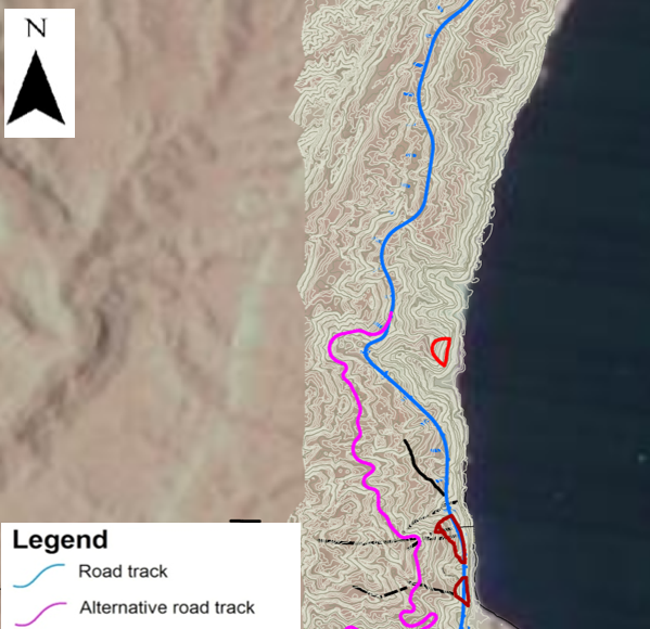
Historical analysis of the state of activity of a landslide in a desert area
Issue
To understand the past evolution of a slope for identifying the most suitable track of a new highway.
Solution
A dedicated satellite SAR interferometric processing approach was specifically developed for dealing with the few images available for the period 2006-2010. In order to take maximum advantage by the desertic surface (with no vegetation cover), and also to overcome problem related to potential fast displacements specific satellite data (L-band) were selected. The best observation geometry was carefully identified and selected.
Achievements
Five local interferometric anomalies, clue of displacements occurred in the past were identified. In the area involved by a recent collapse during working activities, a past small slope collapse was recognized in the observed period so defining the slope past events and suggesting the most critical sector in the road track design.


For further details:
Rocca A., Mazzanti P., Perissin D., Bozzano F., 2014, Detection of past slope activity in a desert area using multi-temporal DInSAR with Alos Palsar data, Italian Journal of Engineering Geology and Environment – Sapienza Università Editrice.