Experimental monitoring site on a large landslide
Need
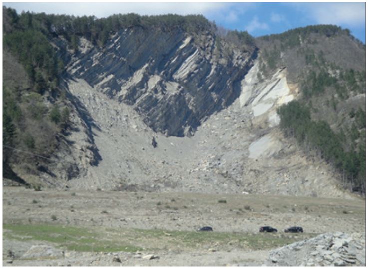
Realize an experimental monitoring site on a recent large landslide, where students, experts or citizens can improve their
knowledge about landslide monitoring and see the most advanced available technological solutions.
Solution
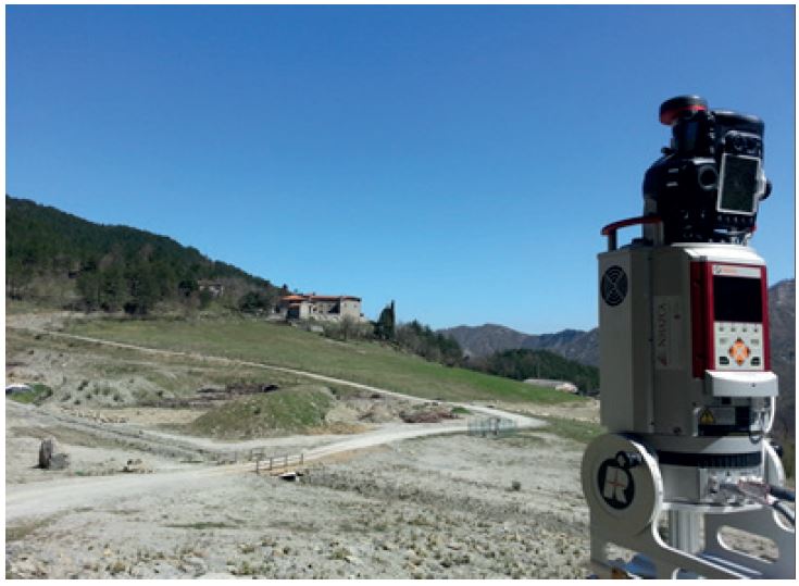
Over the years, several surveys have been carried out using Terrestrial Laser Scanners from different scanning positions in order to obtain a three-dimensional and high-resolution digital model of the slope. In addition, three permanent surveying stations have been realized to perform multitemporal Laser Scanner surveys. Finally, two permanent photogrammetric survey stations have been realized for the analysis through PhotoMonitoring techniques. Every year intensive monitoring campaigns are carried out to study the evolution of the landslide process.
Achievements
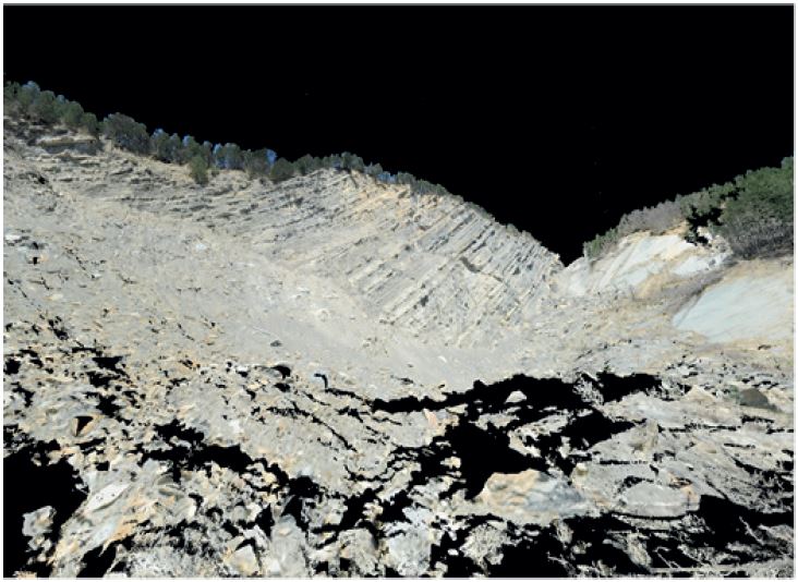
Thanks to the surveys conducted, a three-dimensional model of the landslide in real colour and high resolution was obtained. Numerous detailed analyses were also carried out to identify the geometric variations that occurred during the multi-temporal surveys carried out.
For further details:
Mazzanti P., Bozzano F., Brunetti A., Caporossi P., Esposito C., Scarascia Mugnozza G., 2017, Experimental Landslide Monitoring Site of Poggio Baldi Landslide (Santa Sofia, N-Apennine, Italy), Advancing Culture of Living with Landslides – Springer.