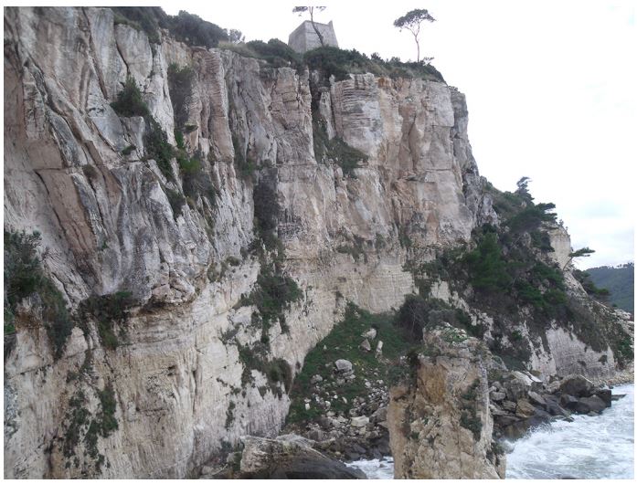
Sea cliff slope stability analysis
Issue
Evaluate the susceptibility to rock fall and topple of a not accessible vertical cliff in limestone material by a remote position.
Solution
An analytical approach based on the integration of results derived from terrestrial remote sensing techniques was developed for this purpose. Specifically, detailed 3D models of the slope were collected by the Terrestrial Laser Scanner, suitable for the geostructural evaluation of the rockmass. Mechanical behaviour of the mass was derived from Terrestrial Infrared multitemporal surveys and a few days Terrestrial InSAR campaign.
Achievement
The main joints pattern and main jointing features of the cliff were derived from the virtual analysis of the 3D points cloud. Displacement maps and time series of specific points of the cliff were collected thus allowing to identify the most released blocks more susceptible to collapse. Priority maps were derived, thus supporting local authorities in charge of land management to drive stabilisation design.


For further details:
Martino S., Mazzanti P., 2014, Integrating geomechanical surveys and remote sensing for sea cliff slope stability analysis: the Mt. Pucci case study (Italy), NHESS – European Geosciences Union.